Simulating travel patterns in urban design
Machine Learning Mode-Distance Model
- Authors: Yang Yang, Timur Dogan
- Date: 2020 - Ongoing
- Link: Urbano.io Website
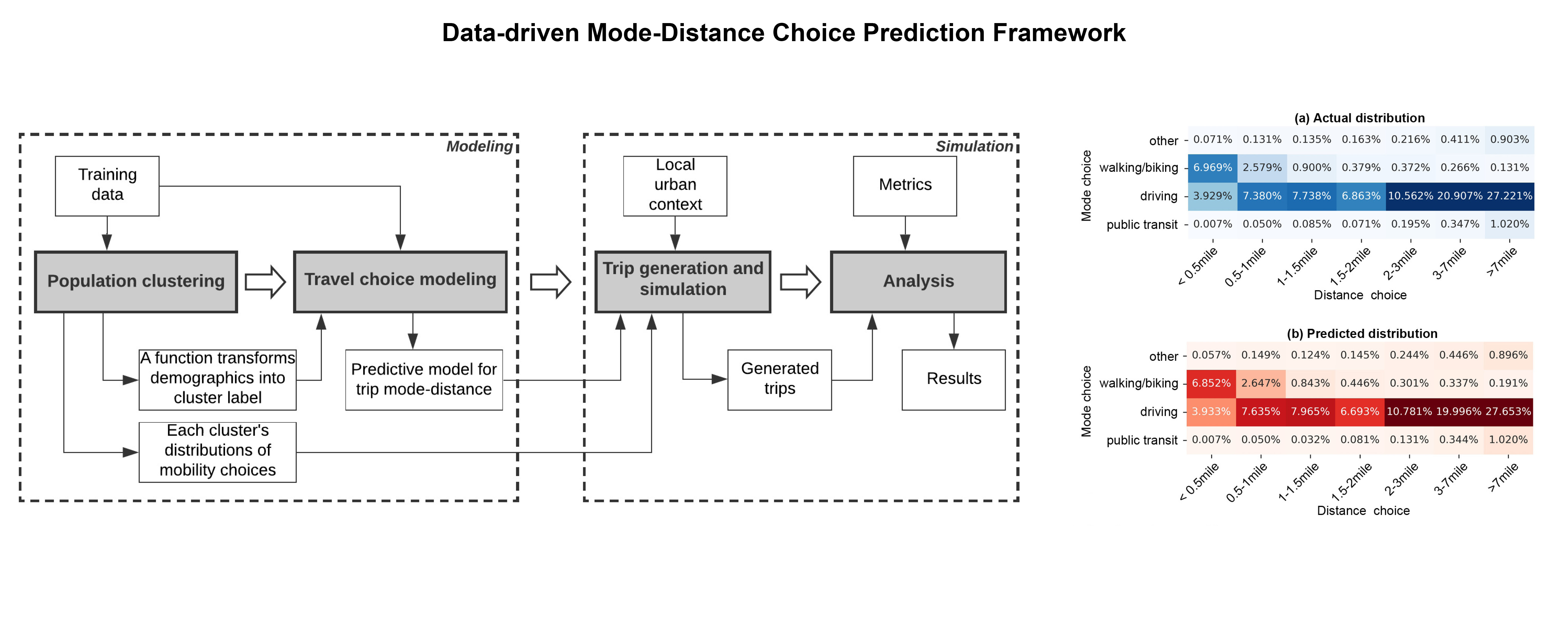
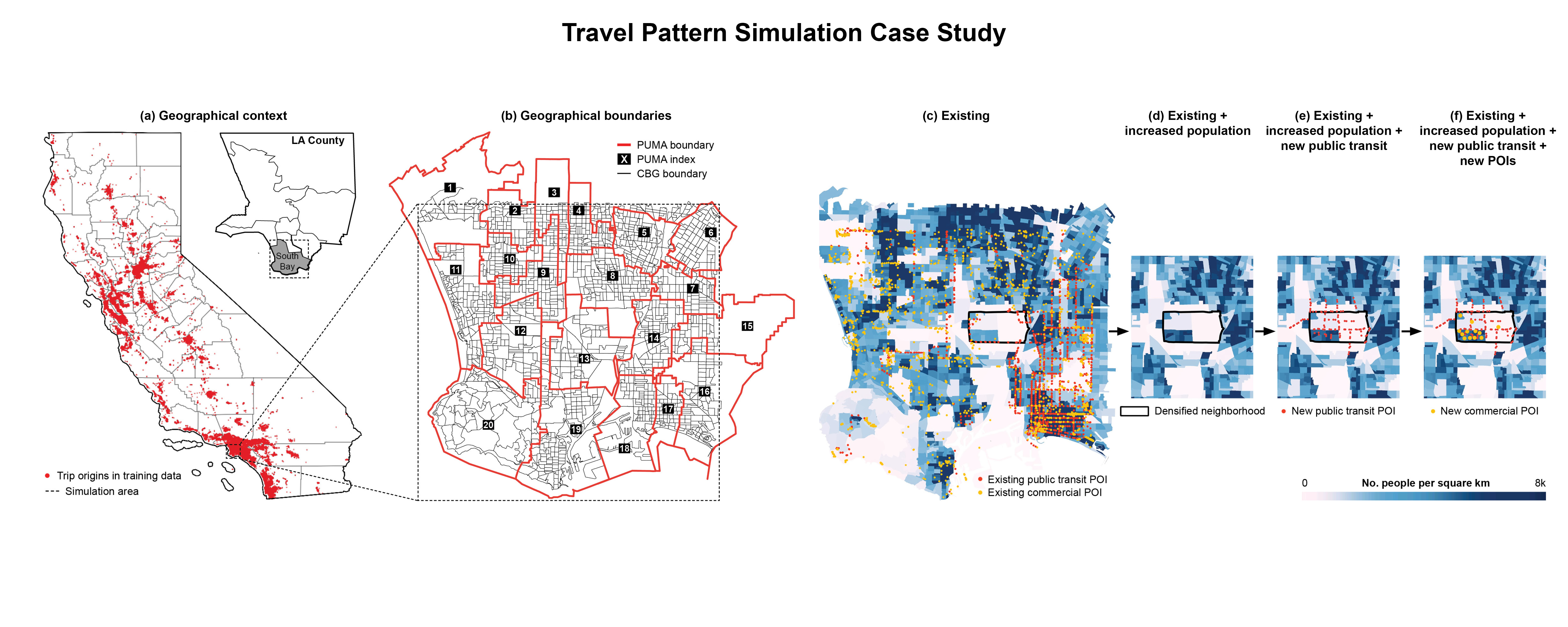
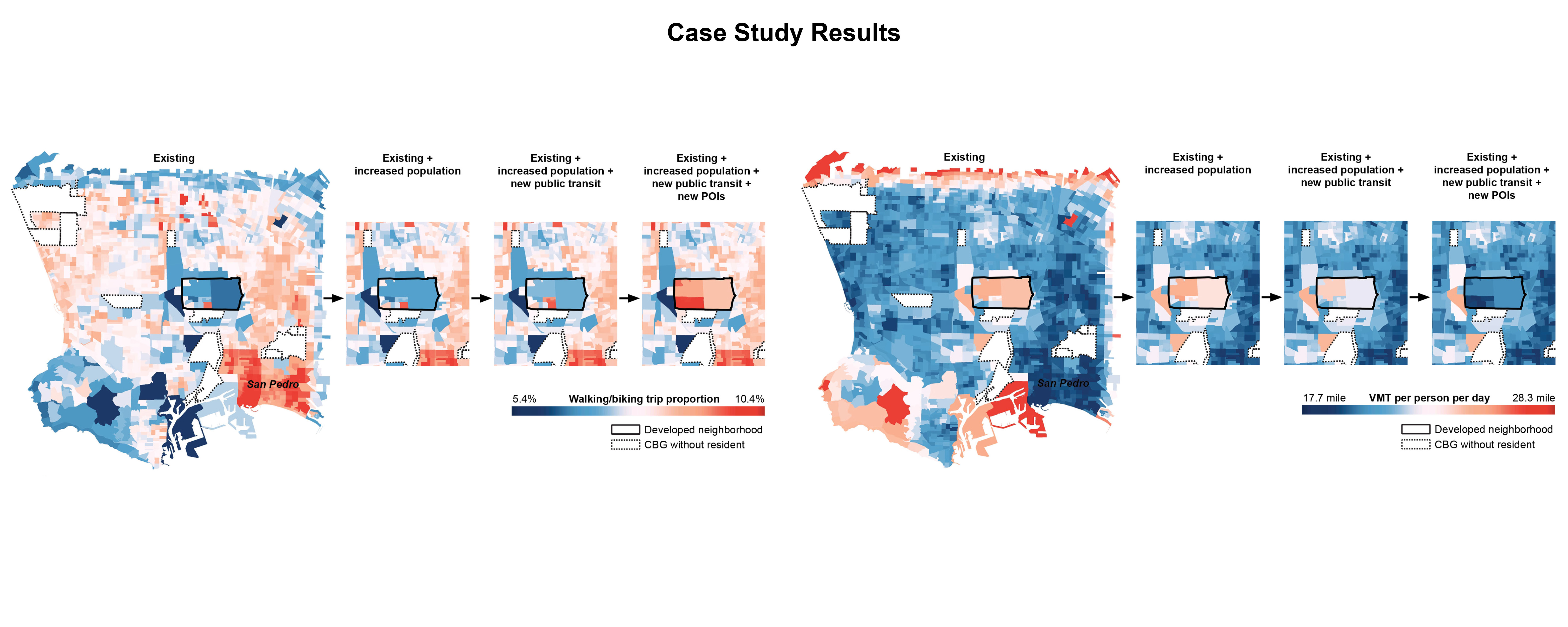
Well-informed mobility-aware decision-making in spatial planning and urban design practice is imperative to reducing vehicle miles traveled (VMT) and advocating sustainable transportation modes. However, integrating transportation consideration into the early-stage design process remains challenging due to the lack of tools to inform designers about the mobility implications of their scenarios. This paper proposes a data-driven framework that utilizes open data sources including the travel survey data, census data, and POI data for modeling and simulating the spatiotemporal mode-distance choice distribution of urban home-based trips (i.e., trips originating from home).
The framework has four main steps including (1) Population clustering, (2) Travel choice modeling, (3) Trip generation and simulation, and (4) Analysis. This framework, for the first time, allows urban designers and planners to efficiently quantify the amount of mode shift that can be elicited and the total VMT that can be reduced by different design scenarios. This methodology is generalizable and expandable due to its data-driven nature, which makes it a practically applicable tool to tackle varying design questions and be adapted to different geographical contexts. Through a proof-of-concept case study in California, we provide evidence that the dense and mixed-use urban development can significantly reduce VMT, advocate active transportation, and increase public transit ridership.